
Page content
Basic Information
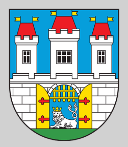
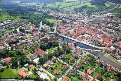 We are pleased to welcome you to the royal town of
Sušice, the gateway to the Šumava Mountains. The town lies 465m above sea level
in the highlands of Svatobor and is situated in a valley bordered by the
undulating terrain of the Kalovy Hills. The former royal town has a population
of approximately 11,500 inhabitants spreading across both banks
of the Otava River and extends over an area of 45.6ha. The area of municipal
woods is 1,172 ha and is the largest municipal property in the Czech Republic.
The woods are crossed by many footpaths.
We are pleased to welcome you to the royal town of
Sušice, the gateway to the Šumava Mountains. The town lies 465m above sea level
in the highlands of Svatobor and is situated in a valley bordered by the
undulating terrain of the Kalovy Hills. The former royal town has a population
of approximately 11,500 inhabitants spreading across both banks
of the Otava River and extends over an area of 45.6ha. The area of municipal
woods is 1,172 ha and is the largest municipal property in the Czech Republic.
The woods are crossed by many footpaths.
How to come to our town?
From the Frontier:
Rozvadov/Waidhaus
First possibility:
Route length:134 km
Rozvadov – Bor –
Horšovský Týn – Domažlice – Klatovy – Kolinec – Sušice
Second possibility:
Route length:130 km
Rozvadov – Plzeň – Klatovy – Sušice
Železná Ruda/ Bayerisch Eisenstein
Route length: 33 km
Železná Ruda - Direction Klatovy, but turn
right after 5 km - Hartmanice - Sušice
Strážný/ Philippsreut
Route length:
57 km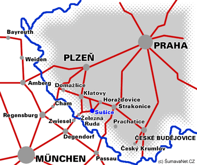
Strážný – Vimperk – Stachy – Kašperské Hory – Sušice
Some of the Czech towns:
Praha:
First possibility:
Route
length: 146 km
Praha – Strakonice – Horažďovice – Sušice
Second
possibility:
Route length: 160 km
Praha – Plzeň – Klatovy – Sušice
České Budějovice:
Route length: 91
km
České Budějovice – Strakonice – Horažďovice - Sušice
Plzeň:
Route length: 70 km
Plzeň – Klatovy – Sušice